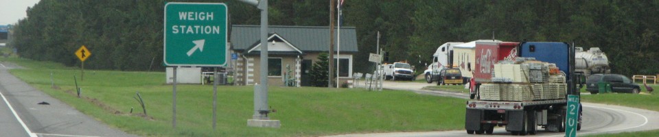

North Platte Weigh Station Information
[wp_ad_camp_1]


[wp_ad_camp_1]
State: Nebraska Scales and DOT
Highway: RT 30 – eb wb
Location: North Platte (1 mile east of route 56 G Link on route 30 (on the south side of the roadway))
Phone: Premium Content
[wp_ad_camp_2]
[wp_ad_camp_1]
Information
This is one scale that weighs trucks in both directions.
To get to the weigh station (or as an alternate route to the freeway if the route 30 North Platte scale is closed), eastbound, take exit 179 route 56G north 1.9 miles to route 30. Turn right on route 30. The weigh station is just east of town on the right in 1.2 miles. After passing or crossing the weigh station, go another 10.5 miles on route 30. You’ll see signs “To I 80.” You’ll make a right turn on route 56A spur and cross the rail road tracks. You’ll go about 2 miles back to I 80 east bound.
To get to the scales westbound, take exit 190, route 56A spur and go north about 2 miles. You’ll cross over the rail road tracks and go to the stop sign at route 30. Turn left on route 30. In 10.5 miles you will come to the scale on your left- when you get to the airport, you’ll be very close to the weigh station. After leaving or passing the weigh station, you’ll go 1.2 miles to the junction of route 56 G Link. There is a small “To I 80″ sign there. You’ll turn left and go 1.9 miles back to the ramp for I 80 west bound.
Lat: 41 8 0 N
Lon: 100 42 16 W